
Aerial Photography on Colorado's Western Slope: A Practical Guide for Commercial and Real Estate Clients
Large parcels, ranch land, and mountain properties on Colorado's Western Slope have features that are invisible from the ground — and critical to buyers. This is a practical guide to when aerial photography earns its cost, and what to look for in a licensed drone operator.
DRONE & AERIAL MEDIA
Doug H
6/16/20264 min leer
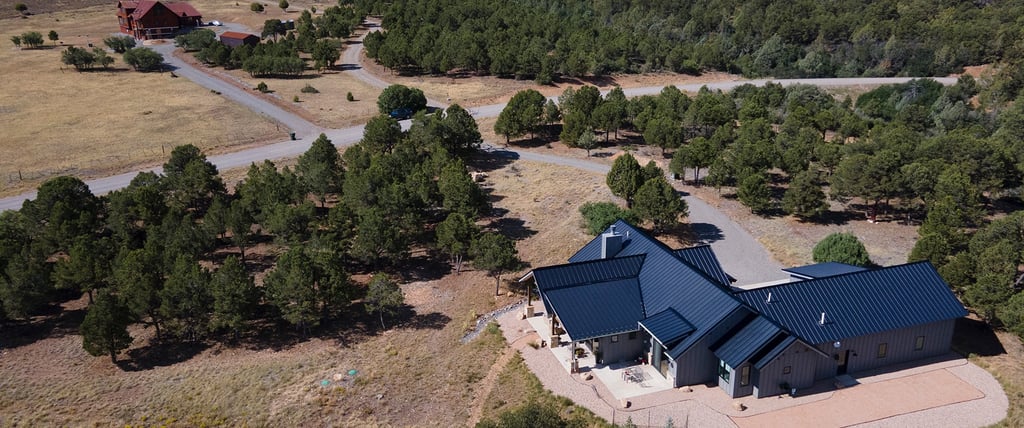
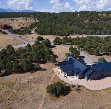
Aerial Photography on Colorado's Western Slope: A Practical Guide for Commercial and Real Estate Clients
Colorado's Western Slope is not a uniform market. The distance between a 1,200-square-foot ranch house in Montrose County and a 300-acre irrigated farm in Delta County — or a commercial development parcel in Grand Junction — represents an enormous range of property types, and that range demands photography approaches that can't be collapsed into a single formula.
Aerial photography is where that divergence matters most. On the Western Slope, aerial imagery isn't a luxury add-on for high-end listings. It's often the most essential piece of documentation a property has — the image that communicates what words and ground-level photos structurally cannot.
This guide is for commercial clients, real estate agents, and property owners on Colorado's Western Slope who want to understand when aerial photography makes a measurable difference, what to look for in a licensed drone operator, and how Blue Moon Medias approaches aerial work in this specific geographic market.
Why Western Colorado Geography Creates Unique Aerial Opportunities
Most aerial photography markets are flat. The Western Slope is not. Properties in and around Montrose, Ouray, Telluride, and the San Juan Mountains sit within some of the most visually distinct geography in the continental United States. Mountain backdrops, river corridors, canyon rims, high desert plains, and dramatic elevation changes give aerial photography in this market a context that simply doesn't exist in most of Colorado — and that context sells.
A buyer looking at a 40-acre parcel outside Montrose doesn't get the full picture from ground-level photos. They need to see the relationship between the property and the mountains behind it. They need to understand the drainage patterns, the road access, the proximity to neighboring parcels. Those things require air.
Ranch Land, Irrigation, and Large Parcels: What Aerial Does That Ground Photos Can't
This is the highest-value application for aerial photography on the Western Slope. Large agricultural parcels — the kind that define much of Montrose County and Delta County real estate — have features that are invisible from the ground and critical to buyers: irrigation system coverage, pivot infrastructure, water rights documentation, fencing perimeters, outbuilding placement, and the relationship between productive and non-productive acreage.
Blue Moon Medias' drone pilot Doug Hollister comes from a water resource management background. When documenting a ranch or agricultural parcel, he's not just capturing square footage from the air — he's reading and documenting land features that buyers and appraisers need to assess value. That professional perspective changes what the aerial footage communicates.
For a buyer evaluating two comparable parcels side-by-side online, the one with aerial documentation that actually shows the irrigation infrastructure wins the inquiry. Full stop. Learn about Doug Hollister and the Blue Moon Medias team
Commercial Property Documentation: When Aerial Is the Product
For commercial properties — retail pads, industrial facilities, mixed-use developments, and commercial land — aerial photography serves a different purpose than it does for residential listings. It's documentation first, marketing second.
Commercial buyers and investors need to understand a property's site footprint, parking configuration, access routes, adjacency to infrastructure, and surrounding land use. These are questions that only an aerial perspective answers cleanly. Aerial documentation is also increasingly standard for commercial insurance surveys and development planning files.
Blue Moon Medias provides commercial aerial photography across the Western Slope for commercial listings, development parcels, retail and industrial properties, and pre-construction documentation. See our commercial aerial photography and drone package options
Residential Listings: When Aerial Earns Its Cost
Not every residential listing needs aerial photography. A townhome in a dense Montrose subdivision gains less from aerial documentation than a single-family home on a half-acre lot with mountain views and a large backyard. The value of aerial photography scales with the property's geographic context and lot characteristics.
The decision framework is straightforward: if the property's location, lot, views, or surrounding land are selling features — aerial is worth it. If the property's primary appeal is interior finishes in a standard subdivision context — aerial is less critical. Blue Moon Medias will advise on this assessment during the booking process.
Cinematic Video vs. Aerial Stills: The Use Case Breakdown
Aerial stills are the production standard for most residential and commercial listings. They're fast to shoot, easy to integrate into MLS listings, Zillow, and marketing materials, and they deliver high-resolution site context efficiently.
Cinematic aerial video — sweeping approaches, tracking shots, altitude reveals — serves a different purpose. It's best suited for luxury listings where emotional engagement is the objective, large parcel sales where the narrative of the land matters, commercial development marketing, and video packages intended for YouTube or social media amplification. View our virtual tour and video production packages
Seasonal Considerations for Western Slope Aerial Shoots
Timing matters on the Western Slope in ways that don't apply to lower-elevation markets. The optimal aerial photography window in Montrose and surrounding areas runs from late spring through early fall — when irrigation is visible, vegetation is green, and the mountain backdrop is at its most photogenic.
Winter aerial shoots are feasible but come with considerations: snow cover can obscure land features critical to agricultural buyers, and wind conditions at elevation can limit certain shots. Blue Moon Medias advises on seasonal timing as part of the project planning process.
Frequently Asked Questions
Q: Do I need an FAA-licensed drone pilot for real estate aerial photography in Colorado?
A: Yes. Any commercial drone operation — including real estate listing photography — requires FAA Part 107 certification under federal law. Blue Moon Medias' aerial photography is conducted exclusively by FAA Part 107 licensed pilot Doug Hollister.
Q: What types of Western Slope properties benefit most from aerial photography?
A: Large parcels, agricultural and ranch land, rural residential properties with mountain views or acreage, commercial properties, and development parcels gain the most from aerial documentation. Blue Moon Medias can advise on whether aerial photography will deliver measurable value for a specific property.
Q: How far in advance should I book aerial photography for a Western Slope listing?
A: We recommend booking at least 3–5 business days in advance, particularly during peak listing season (spring and summer). Same-week availability is often possible but not guaranteed. Weather windows on the Western Slope can require flexibility in scheduling, especially for cinematic video shoots.
Ready to put aerial photography to work on your Western Slope listing or commercial project?
→ Contact Blue Moon Medias to discuss your aerial photography needs


© Copyright 2026 Blue Moon Medias, LLC All Rights Reserved.
We Use the World’s Finest Virtual Tour Software!